Getting there
- Flights to Cusco (CUZ) 45 km from the start
Treks / Peru
Peru · Nearest city: Cusco
Four days on original stone paths to Machu Picchu. Day two climbs to Dead Woman's Pass at 4,215 m and the stone steps are hard on the knees.
Watch out: Permits are limited and sell out months ahead. Spend a few days in Cusco first to acclimatise.
It's the only way to arrive at Machu Picchu on foot through the Sun Gate, on original Inca paving.
The classic four-day Inca Trail from Km 82, walked only with a licensed operator. Permits are limited to a few hundred people a day, including porters.
A gentle start along the Urubamba river past the ruins of Llactapata.
Sleep: Wayllabamba campsite
The hardest day: a long climb on stone steps to Dead Woman's Pass.
Sleep: Pacaymayo campsite (3,600 m)
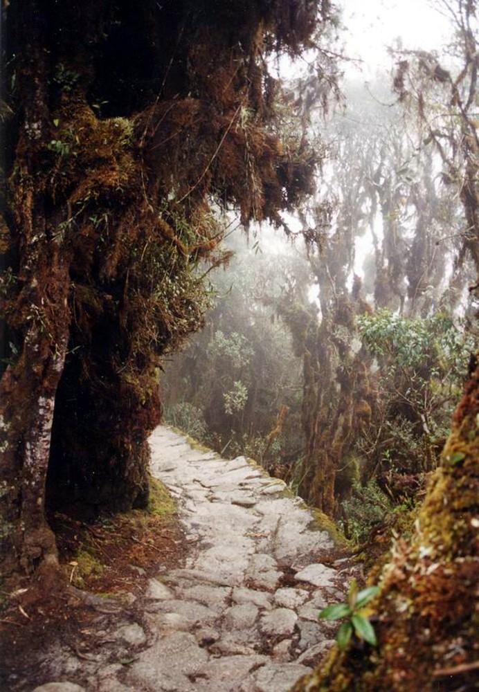
Cloud forest and the ruins of Sayacmarca, Phuyupatamarca and Wiñay Wayna. The most varied day.
Sleep: Wiñay Wayna campsite (2,650 m)
A pre-dawn start to the Sun Gate and your first view of Machu Picchu.
Sleep: Aguas Calientes
Arriving at Inti Punku, the Sun Gate, on day 4 at dawn, when Machu Picchu appears below you for the first time.
Day 1 is gentle. Most people add rest days in Cusco before the trek to acclimatise.
Some of these are affiliate links: if you book through them we may earn a small commission, at no extra cost to you. We only list services that fit this trek.
Roaming in Peru is expensive on most phone plans. A data eSIM bought before you fly gets you online as soon as you land.
Expect long stretches with no signal on the trail. Download offline maps and our GPX before you start.
This trek reaches 4,215 m, and many policies stop covering hiking at 2,000 to 3,000 m unless you add an activity upgrade. World Nomads needs its Level 3 activities above 2,000 m, Heymondo its Adventure add-on above 3,000 m, and SafetyWing's Nomad Insurance covers trekking up to 4,500 m.
Rescue is not the same as evacuation. Travel insurance usually pays to fly you to hospital, but not always for the search and rescue itself. Read the policy's "search and rescue" section.
True Traveller sells only to UK and EEA residents. Always check the altitude limit and your country of residence in the policy wording. Our trekking insurance guide explains what to look for.
All camping is at designated campsites organised by your operator.
Rules change and differ between parks. Check with the local park or tourist office before you pitch a tent.
Map layers load on the live site. Use the overview below meanwhile.
Straight lines between stops One colour per day (dashed: straight line, not the exact path) Start / finish Stop on the way Nearest city
Switch between Topo, Satellite and Street layers with the layer button, and turn on the marked hiking trails overlay. We don't have the exact trail for this route yet, so stops are joined with straight lines. Always carry a proper hiking map on the trail.
Stops: Ollantaytambo → Warmiwañusqa → Machu Picchu
Best time: April to October (closed in February)
The dry seasons (see best season above)
Clearest skies and most stable weather, but cold nights at altitude and busy trails.
Bring
Edges of the dry season
Fewer people and cheaper trips, with a higher chance of cloud, rain or snow.
Bring
Rainy months
Mud, cloud and closed views. Some routes close entirely, like the Inca Trail in February.
Bring
You'll feel the altitude on the climbs. Spend a night or two in the mountains first if you can, and pace yourself.
Plan for rain on most days. A proper waterproof jacket, a pack liner and quick-dry clothes keep you comfortable.
8 photos taken on and around the route by Wikimedia Commons photographers. Tap one to see it bigger.
Photo credits: Incatrail in Peru by the author named on its Commons page, Public domain, via Wikimedia Commons; Machu Picchu by Draceane, CC BY-SA 4.0, via Wikimedia Commons; Ollantaytambo - Heiliges Tal by FLASHPACKER TRAVELGUIDE, CC BY-SA 2.0, via Wikimedia Commons; Inca-trail-day by Shriram Rajagopalan, CC BY 2.0, via Wikimedia Commons; Inca Trail, Peru by Christoph Strässler, CC BY-SA 2.0, via Wikimedia Commons; Mistorama by Jay Sterling Austin from San Francisco, United States, CC BY 2.0, via Wikimedia Commons; Phuyupatamarca Camp site, Inca Trail, Peru by Christoph Strässler, CC BY-SA 2.0, via Wikimedia Commons; Vista desde la plaza de armas de Ollantaytambo - panoramio by CarlosE Duarte, CC BY 3.0, via Wikimedia Commons. Photos resized for the web. Figures are approximate and vary with the variant you choose.

.jpg)


.jpg)

