Getting there
- Flights to Bologna (BLQ) right by the start
Treks / Italy
Italy · Nearest city: Bologna (also Florence)
A five- or six-day walk over the Apennines from Bologna to Florence, partly on a Roman road, with food as good as the views.
Watch out: Accommodation along the route fills up in spring and autumn. Book early.
It links two great food cities, Bologna and Florence, over the Apennines, partly on an ancient Roman road.
Some of these are affiliate links: if you book through them we may earn a small commission, at no extra cost to you. We only list services that fit this trek.
Phone plans from the EU and EEA roam here at home prices. Coming from the US, UK or elsewhere? A Europe data eSIM is usually far cheaper than roaming.
Expect long stretches with no signal on the trail. Download offline maps and our GPX before you start.
Most travel insurance includes hiking at this height. Check that hiking is listed and that medical evacuation is covered.
Rescue is not the same as evacuation. Travel insurance usually pays to fly you to hospital, but not always for the search and rescue itself. Read the policy's "search and rescue" section, or join an Alpine club: membership of the Austrian Alpenverein (it has an English-speaking UK section) includes rescue cover of up to €25,000.
True Traveller sells only to UK and EEA residents. Always check the altitude limit and your country of residence in the policy wording. Our trekking insurance guide explains what to look for.
Rules vary by region and park. Bivouacs are often tolerated high in the mountains for one night; camping in valleys and parks is usually restricted.
Rules change and differ between parks. Check with the local park or tourist office before you pitch a tent.
Map layers load on the live site. Use the overview below meanwhile.
Trail from OpenStreetMap (120.6 km) Route variant Start / finish Stop on the way Nearest city
Switch between Topo, Satellite and Street layers with the layer button, and turn on the marked hiking trails overlay. The trail line is the OpenStreetMap hiking route and may differ from the variant you choose. Always carry a proper hiking map on the trail.
Stops: Bologna → Monzuno → Madonna dei Fornelli → San Piero a Sieve → Fiesole → Florence
Best time: April to October
March to May
The best time for most people: green hills, wildflowers and comfortable temperatures.
Bring
June to August
Hot, often above 30°C, with little shade. Start at dawn and rest in the afternoon. Fire risk can close paths.
Bring
September to November
Warm sea and settled weather in early autumn, with the first storms arriving later.
Bring
Start at dawn, rest in the shade at midday, and carry more water than you think. Electrolytes help.
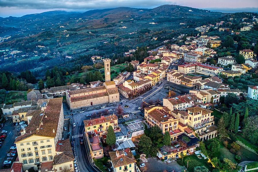
6 photos taken on and around the route by Wikimedia Commons photographers. Tap one to see it bigger.
Photo credits: Fiesole by Hagai Agmon-Snir حچاي اچمون-سنير חגי אגמון-שניר, CC BY-SA 4.0, via Wikimedia Commons; Torri di Bologna, Bologna by Fabio Ciminelli, CC BY-SA 4.0, via Wikimedia Commons; MonzunoPanorama by LigaDue, CC BY-SA 4.0, via Wikimedia Commons; Reno River (explored) - Flickr - Strocchi by Enrico Strocchi from Forlì, Italy, CC BY-SA 2.0, via Wikimedia Commons; View near Fiesole by Hagai Agmon-Snir حچاي اچمون-سنير חגי אגמון-שניר, CC BY-SA 4.0, via Wikimedia Commons; Baragazza vista dalla strada per Bruscoli by Lucianux021279, CC BY-SA 4.0, via Wikimedia Commons. Photos resized for the web. Figures are approximate and vary with the variant you choose.


_-_Flickr_-_Strocchi.jpg)

