Getting there
- Flights to Reykjavík (KEF) 175 km from the start
Treks / Iceland
Iceland · Nearest city: Reykjavík
Iceland's most famous trek, from the rhyolite mountains of Landmannalaugar to the valley of Þórsmörk, past steaming vents and black deserts.
Watch out: Weather can be wintry even in July, and river crossings are cold. Book huts well ahead.
It's one of the world's most colourful treks, through rhyolite mountains, lava fields and black deserts in just four days.
The classic four-day walk from Landmannalaugar to Þórsmörk, staying in the Icelandic Touring Association's huts or their campsites.
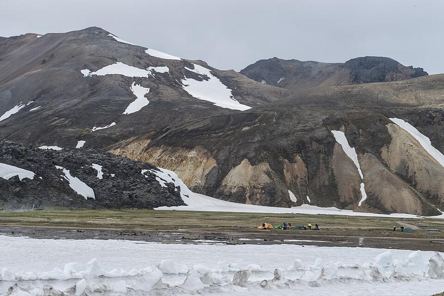
Colourful rhyolite mountains, steam vents and fields of black obsidian. The hardest climb of the trek.
Sleep: Hrafntinnusker hut or campsite
The big descent with glaciers in view and the first river crossing.
Sleep: Álftavatn hut or campsite
Black sand desert and the deep Markarfljót canyon. Ford the Bláfjallakvísl river.
Sleep: Emstrur (Botnar) hut or campsite
From desert back into green birch woods, with a final river crossing at Þröngá.
Sleep: Langidalur or Básar huts in Þórsmörk
Day 2, as you descend from the Hrafntinnusker plateau, the glaciers Mýrdalsjökull and Eyjafjallajökull and the Álftavatn lake open up below you.
Þórsmörk at the end is worth an extra night: short hikes in birch valleys, or continue over Fimmvörðuháls to Skógar if you have legs left.
Some of these are affiliate links: if you book through them we may earn a small commission, at no extra cost to you. We only list services that fit this trek.
Phone plans from the EU and EEA roam here at home prices. Coming from the US, UK or elsewhere? A Europe data eSIM is usually far cheaper than roaming.
Expect long stretches with no signal on the trail. Download offline maps and our GPX before you start.
Most travel insurance includes hiking at this height. Check that hiking is listed and that medical evacuation is covered.
Rescue is not the same as evacuation. Travel insurance usually pays to fly you to hospital, but not always for the search and rescue itself. Read the policy's "search and rescue" section.
True Traveller sells only to UK and EEA residents. Always check the altitude limit and your country of residence in the policy wording. Our trekking insurance guide explains what to look for.
Camp only at the designated campsites next to each hut. Wild camping along the route is not allowed.
Rules change and differ between parks. Check with the local park or tourist office before you pitch a tent.
Map layers load on the live site. Use the overview below meanwhile.
Trail from OpenStreetMap (50.0 km) One colour per dayRoute variant Start / finish Stop on the way Nearest city
Switch between Topo, Satellite and Street layers with the layer button, and turn on the marked hiking trails overlay. The trail line is the OpenStreetMap hiking route and may differ from the variant you choose. Always carry a proper hiking map on the trail.
Stops: Landmannalaugar → Þórsmörk
Best time: Late June to early September
Late June to early July
Snow on high ground, high rivers from snowmelt and cold nights. Routes and huts may still be opening.
Bring
Mid-July to mid-August
The main window, with the best chance of dry weather, but conditions can still turn wintry.
Bring
Late August to early September
Fewer people and darker nights, with storms becoming more frequent and huts starting to close.
Bring
You'll ford rivers without bridges. Cross early in the day when levels are lower, unclip your hip belt, and use poles. Bring sandals or light shoes for crossing.
Exposed ridges and summits can be very windy and cold. A windproof layer and hat are worth carrying even on warm days.
Early in the season, snow can cover the path on high ground. Microspikes or crampons and some experience make these sections safer.
9 photos taken on and around the route by Wikimedia Commons photographers. Tap one to see it bigger.
Photo credits: Landmannalaugar Campsite by Anjali Kiggal, CC BY-SA 4.0, via Wikimedia Commons; Þórsmörk from Valahnúksból by David Karnå, CC BY 3.0, via Wikimedia Commons; Landscape during Laugavegur hiking trail by Chmee2/Valtameri, CC BY 3.0, via Wikimedia Commons; Rural mountains with snow by Amy Hanley a_hanley, CC0, via Wikimedia Commons; Thórsmörk, Iceland by Jonatan Pie r3dmax, CC0, via Wikimedia Commons; View on Landmannalaugar area from Laugavegur panoramic by Borvan53, CC BY-SA 4.0, via Wikimedia Commons; Iceland nature by Pavel Marianov, CC BY 2.0, via Wikimedia Commons; Cueva excavada en el hielo por aguas termales, Islandia by Gaianauta, CC BY-SA 3.0, via Wikimedia Commons; Rainbow Mountains in Landmannalaugar region by Chmee2, CC BY 3.0, via Wikimedia Commons. Photos resized for the web. Figures are approximate and vary with the variant you choose.


.jpg)
.jpg)


.jpg)