Getting there
- Flights to Glasgow (GLA) 25 km from the start
Treks / United Kingdom (Scotland)
United Kingdom (Scotland) · Nearest city: Edinburgh (also Glasgow)
A coast-to-coast walk across Scotland's central belt, from Helensburgh to Dunbar, birthplace of the conservationist John Muir.
Watch out: Mostly easy walking, with some road sections between towns.
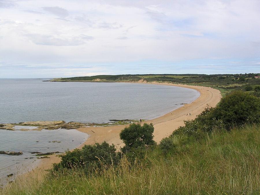
It crosses Scotland coast to coast through canals, castles and beaches, with trains never far away.
Some of these are affiliate links: if you book through them we may earn a small commission, at no extra cost to you. We only list services that fit this trek.
EU 'roam like at home' doesn't apply in United Kingdom, and many plans charge extra there. A Europe data eSIM covers United Kingdom too.
Expect long stretches with no signal on the trail. Download offline maps and our GPX before you start.
Most travel insurance includes hiking at this height. Check that hiking is listed and that medical evacuation is covered.
Rescue is not the same as evacuation. Travel insurance usually pays to fly you to hospital, but not always for the search and rescue itself. Read the policy's "search and rescue" section.
True Traveller sells only to UK and EEA residents. Always check the altitude limit and your country of residence in the policy wording. Our trekking insurance guide explains what to look for.
Wild camping is allowed in most of Scotland under the Scottish Outdoor Access Code, if you camp lightly and move on. Parts of Loch Lomond & The Trossachs need a permit from March to September.
Rules change and differ between parks. Check with the local park or tourist office before you pitch a tent.
Map layers load on the live site. Use the overview below meanwhile.
Trail from OpenStreetMap (213.8 km) Start / finish Stop on the way Nearest city
Switch between Topo, Satellite and Street layers with the layer button, and turn on the marked hiking trails overlay. The trail line is the OpenStreetMap hiking route and may differ from the variant you choose. Always carry a proper hiking map on the trail.
Stops: Helensburgh → Balloch → Falkirk → Linlithgow → Edinburgh → North Berwick → Dunbar
Best time: April to October
April to May
Often the driest time of year, with long days and fresh green hills. Can still be cold and windy on the tops.
Bring
June to August
Longest days and warmest weather, but also rain showers, busier trails and, in Scotland, midges.
Bring
September to October
Fewer people and beautiful colours, but wetter, windier weather and shorter days.
Bring
Plan for rain on most days. A proper waterproof jacket, a pack liner and quick-dry clothes keep you comfortable.
9 photos taken on and around the route by Wikimedia Commons photographers. Tap one to see it bigger.
Photo credits: Gullane Beach by Mmt at English Wikipedia, Public domain, via Wikimedia Commons; Tolbooth, Dunbar High Street by Kim Traynor, CC BY-SA 3.0, via Wikimedia Commons; Colquhoun Square, showing plinths for the Outdoor Museum by Stewartnbl, CC BY-SA 4.0, via Wikimedia Commons; Linlithgow Palace by Magnus Hagdorn from UK, CC BY-SA 2.0, via Wikimedia Commons; Marker stone by the Forth and Clyde Canal - geograph.org.uk by Alan O'Dowd, CC BY-SA 2.0, via Wikimedia Commons; Forth and Clyde canal towpath near Kirkintilloch - geograph.org.uk by Alec MacKinnon, CC BY-SA 2.0, via Wikimedia Commons; Rhododendrons in bloom - geograph.org.uk by Jim Smillie, CC BY-SA 2.0, via Wikimedia Commons; Path beside Greenbank Road - geograph.org.uk by Richard Webb, CC BY-SA 2.0, via Wikimedia Commons; Cycle path, Tamfourhill Wood - geograph.org.uk by Richard Webb, CC BY-SA 2.0, via Wikimedia Commons. Photos resized for the web. Figures are approximate and vary with the variant you choose.


.jpg)


