Getting there
- Flights to Granada (GRX) 45 km from the start
- Flights to Málaga (AGP) 105 km from the start
Treks / Spain
Spain · Nearest city: Granada
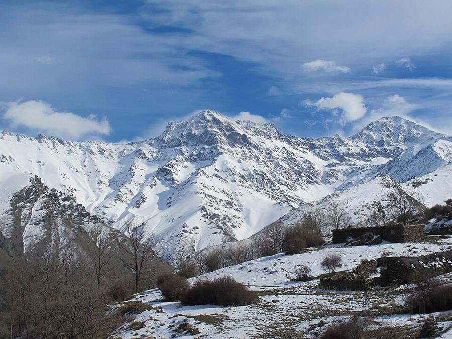
The highest mountain in mainland Spain, in the Sierra Nevada above Granada. A long day or an overnight at a refuge.
Watch out: No shade and strong sun at altitude. Afternoon storms are possible in summer.
It's the highest mountain in mainland Spain, climbed in a day or an overnight from the white villages of the Alpujarras.
Some of these are affiliate links: if you book through them we may earn a small commission, at no extra cost to you. We only list services that fit this trek.
Phone plans from the EU and EEA roam here at home prices. Coming from the US, UK or elsewhere? A Europe data eSIM is usually far cheaper than roaming.
Expect long stretches with no signal on the trail. Download offline maps and our GPX before you start.
This trek reaches 3,479 m, and many policies stop covering hiking at 2,000 to 3,000 m unless you add an activity upgrade. World Nomads needs its Level 3 activities above 2,000 m, Heymondo its Adventure add-on above 3,000 m, and SafetyWing's Nomad Insurance covers trekking up to 4,500 m.
Rescue is not the same as evacuation. Travel insurance usually pays to fly you to hospital, but not always for the search and rescue itself. Read the policy's "search and rescue" section.
True Traveller sells only to UK and EEA residents. Always check the altitude limit and your country of residence in the policy wording. Our trekking insurance guide explains what to look for.
Wild camping is regulated by each region and generally banned in natural parks. Mountain refuges and campsites are the norm.
Rules change and differ between parks. Check with the local park or tourist office before you pitch a tent.
Map layers load on the live site. Use the overview below meanwhile.
Straight lines between stops Start / finish Stop on the way Nearest city
Switch between Topo, Satellite and Street layers with the layer button, and turn on the marked hiking trails overlay. We don't have the exact trail for this route yet, so stops are joined with straight lines. Always carry a proper hiking map on the trail.
Stops: Capileira → Mulhacén
Best time: June to October
May to June
Snow can linger high up in early June; lower slopes are green and pleasant.
Bring
July to August
Hot and dry, with little water on the mountains and afternoon storms around the summits.
Bring
September to October
Often the nicest time: cooler days, clear air and quieter trails.
Bring
Start at dawn, rest in the shade at midday, and carry more water than you think. Electrolytes help.
You'll feel the altitude on the climbs. Spend a night or two in the mountains first if you can, and pace yourself.
Thunderstorms often build after midday in summer. Start early, cross passes and summits before noon, and never shelter under lone trees or on ridges.
7 photos taken on and around the route by Wikimedia Commons photographers. Tap one to see it bigger.
Photo credits: Alcazaba, Punta de la Cornisa y Mulhacén . m by Juanjosepascua, CC BY-SA 3.0 es, via Wikimedia Commons; Sierra Nevada desde el embalse del Cubillas, en Atarfe Granada by Lopezsuarez, CC0, via Wikimedia Commons; Capileira seen from the Sulayr Trail by Trougnouf (Benoit Brummer), CC BY 4.0, via Wikimedia Commons; Runoff ice from Laguna Hondera in Capileira, Sierra Nevada National Park by Trougnouf (Benoit Brummer), CC BY 4.0, via Wikimedia Commons; Day - Capileira to Trevélez - panoramio by Hans Braam, CC BY 3.0, via Wikimedia Commons; Day - Capileira to Trevélez - panoramio by Hans Braam, CC BY 3.0, via Wikimedia Commons; Day - Refugio de Poqueira to Refugio de la Carihuela - panoramio by Hans Braam, CC BY 3.0, via Wikimedia Commons. Photos resized for the web. Figures are approximate and vary with the variant you choose.

.jpg)
.jpg)
.jpg)

.jpg)
.jpg)