Getting there
- Flights to Albany (ALB) 160 km from the start
Treks / USA (New York)
USA (New York) · Nearest city: New York City (also Albany)
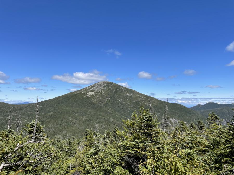
The highest peak in New York State, in the Adirondacks, reached on a long day through forest to an open summit.
Watch out: Trails can be very muddy. Stay on rock above the treeline to protect alpine plants.
It's the highest point in New York State and the heart of the Adirondacks' High Peaks.
Some of these are affiliate links: if you book through them we may earn a small commission, at no extra cost to you. We only list services that fit this trek.
Roaming in USA is expensive on most phone plans. A data eSIM bought before you fly gets you online as soon as you land.
Expect long stretches with no signal on the trail. Download offline maps and our GPX before you start.
Most travel insurance includes hiking at this height. Check that hiking is listed and that medical evacuation is covered.
Rescue is not the same as evacuation. Travel insurance usually pays to fly you to hospital, but not always for the search and rescue itself. Read the policy's "search and rescue" section.
True Traveller sells only to UK and EEA residents. Always check the altitude limit and your country of residence in the policy wording. Our trekking insurance guide explains what to look for.
In national parks, overnight stays need a wilderness permit and camping is often limited to designated sites. On most national forest and BLM land, dispersed camping is allowed.
Rules change and differ between parks. Check with the local park or tourist office before you pitch a tent.
Map layers load on the live site. Use the overview below meanwhile.
Straight lines between stops Start / finish Stop on the way Nearest city
Switch between Topo, Satellite and Street layers with the layer button, and turn on the marked hiking trails overlay. We don't have the exact trail for this route yet, so stops are joined with straight lines. Always carry a proper hiking map on the trail.
Stops: Adirondak Loj → Mount Marcy
Best time: June to October
April to June
Mud season in the north, blackflies in May and June, and fresh green forests.
Bring
July to August
Warm and humid in the forests, with thunderstorms and cool, windy summits.
Bring
September to October
Famous fall colours and crowds, with early snow and ice on higher summits.
Bring
Expect wet feet on peaty or muddy ground. Waterproof boots and gaiters help; so do spare socks.
7 photos taken on and around the route by Wikimedia Commons photographers. Tap one to see it bigger.
Photo credits: Mount Marcy viewed from Mount Skylight in summer by Rocfan275, CC BY-SA 4.0, via Wikimedia Commons; ADK Loj, North Elba, NY by Mwanner, CC BY-SA 3.0, via Wikimedia Commons; View south-southeast from the southwest side of the summit of Mount Marcy in Keene, Essex County, New York by Famartin, CC BY-SA 4.0, via Wikimedia Commons; View north along the Van Hoevenberg Trail about . miles south of the trailhead in North Elba, Essex County, New York by Famartin, CC BY-SA 4.0, via Wikimedia Commons; Mt Van Hoevenberg summit view sunbeam Lake Placid NY by G. Edward Johnson, CC BY 4.0, via Wikimedia Commons; View south down the Van Hoevenberg Trail as it crosses a marshy stream on a boardwalk about . miles south of the trailhead in North Elba, Essex County, New York by Famartin, CC BY-SA 4.0, via Wikimedia Commons; View west from the northwest side of the summit of Mount Marcy in Keene, Essex County, New York by Famartin, CC BY-SA 4.0, via Wikimedia Commons. Photos resized for the web. Figures are approximate and vary with the variant you choose.


