Getting there
- Flights to Mammoth Lakes (MMH) 70 km from the start
- Flights to Fresno (FAT) 105 km from the start
Treks / USA (California)
USA (California) · Nearest city: San Francisco (also Los Angeles, Fresno)
A classic long trail through the High Sierra from Yosemite Valley to the summit of Mount Whitney, crossing a string of passes above 3,300 m.
Watch out: Wilderness permits are very hard to get. Most of the route sleeps above 3,000 m, so acclimatise first.
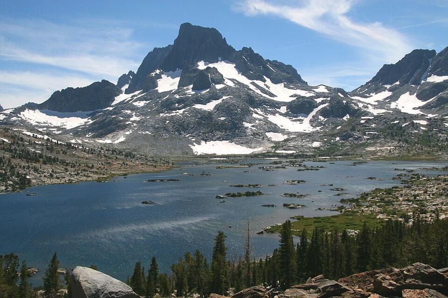
It's often called America's most beautiful trail, through the High Sierra's granite, lakes and passes.
Some of these are affiliate links: if you book through them we may earn a small commission, at no extra cost to you. We only list services that fit this trek.
Roaming in USA is expensive on most phone plans. A data eSIM bought before you fly gets you online as soon as you land.
Expect long stretches with no signal on the trail. Download offline maps and our GPX before you start.
This trek reaches 4,421 m, and many policies stop covering hiking at 2,000 to 3,000 m unless you add an activity upgrade. World Nomads needs its Level 3 activities above 2,000 m, Heymondo its Adventure add-on above 3,000 m, and SafetyWing's Nomad Insurance covers trekking up to 4,500 m.
Rescue is not the same as evacuation. Travel insurance usually pays to fly you to hospital, but not always for the search and rescue itself. Read the policy's "search and rescue" section.
True Traveller sells only to UK and EEA residents. Always check the altitude limit and your country of residence in the policy wording. Our trekking insurance guide explains what to look for.
In national parks, overnight stays need a wilderness permit and camping is often limited to designated sites. On most national forest and BLM land, dispersed camping is allowed.
Rules change and differ between parks. Check with the local park or tourist office before you pitch a tent.
Map layers load on the live site. Use the overview below meanwhile.
Trail from OpenStreetMap (335.7 km) Start / finish Stop on the way Nearest city
Switch between Topo, Satellite and Street layers with the layer button, and turn on the marked hiking trails overlay. The trail line is the OpenStreetMap hiking route and may differ from the variant you choose. Always carry a proper hiking map on the trail.
Stops: Yosemite Valley → Tuolumne Meadows → Devils Postpile National Monument → Muir Pass → Forester Pass → Mount Whitney
Best time: July to September
June to early July
Snow on high passes, high creek crossings and roaring waterfalls. Mosquitoes emerge.
Bring
Mid-July to August
Stable, dry weather with afternoon thunderstorms over the high peaks. Permits are hardest to get.
Bring
September to early October
Clear, quiet and cold at night, with waterfalls reduced and the first snow possible.
Bring
Above about 3,000 m the air holds less oxygen. Walk slowly, drink plenty, don't rush acclimatisation days, and go down if you get a bad headache, nausea or confusion.
Store food in a bear canister or locker, cook away from your tent, and carry bear spray where rangers recommend it.
You'll ford rivers without bridges. Cross early in the day when levels are lower, unclip your hip belt, and use poles. Bring sandals or light shoes for crossing.
7 photos taken on and around the route by Wikimedia Commons photographers. Tap one to see it bigger.
Photo credits: Mt Banner and Thousand Island Lake by Dcrjsr (talk · contribs), CC BY 3.0, via Wikimedia Commons; Tunnel View, Yosemite Valley, Yosemite NP - Diliff by Diliff, CC BY-SA 3.0, via Wikimedia Commons; Tuolumne Meadows Sunset by Steve Dunleavy from Lake Tahoe, NV, United States, CC BY 2.0, via Wikimedia Commons; Marmota flaviventris (Yellow Bellied Marmot), Yosemite NP - Diliff by Diliff, CC BY-SA 3.0, via Wikimedia Commons; West u.s.a by rob Stoeltje from loenen, netherlands, CC BY 2.0, via Wikimedia Commons; Yosemite Valley May - Flickr - Harold Litwiler, Poppy by Harold Litwiler from Orcutt/Istanbul, USA, CC BY-SA 2.0, via Wikimedia Commons; Sunrise over mirror lake mt. whitney wilderness by Ben Kucinski, CC BY 2.0, via Wikimedia Commons. Photos resized for the web. Figures are approximate and vary with the variant you choose.


,_Yosemite_NP_-_Diliff.jpg)
.jpg)

